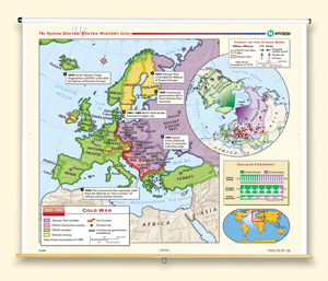
COLD WAR, 1945–1991
Map on spring roller with backboard
The main part of the map shows Europe, with color shading indicating Warsaw Pact members, other communist countries, NATO members, and neutral countries. The map also shows the Iron Curtain, dates when communist governments were established in eastern European countries, and text boxes describing signal events in the history of the Cold War in Europe. A circular inset, with a map centered on the North Pole, focuses on the threat of the atomic bomb, with color shading showing NATO countries and other allies versus Warsaw Pact countries, symbols denoting missile sites and airbases, and arrows indicating paths of potential nuclear attack. Another inset has a chart comparing the nuclear firepower of the U.S. and Soviet Union in terms of ballistic missiles, strategic bombers, and nuclear submarines.

