ENCOMPASS: EXPLORING TEXAS, GRADE 4
Encompass: Exploring Texas, Grade 4 is a hands-on, interactive program crafted for Lone Star State classrooms. Designed to meet the needs of Grade 4 students, this program is aligned with the TEKS standards, providing everything needed to explore Texas’s sprawling landscapes, rich history, and diverse communities. With engaging materials like Texas-specific maps, globes, and atlases, students will saddle up for a journey through the heart of Texas, building essential skills while uncovering the legacy of longhorns, pioneers, and the vibrant culture of the Lone Star State.
Complete Program Components:
Exploring Texas Atlas
This comprehensive atlas is the centerpiece of the program, guiding students through the geography, history, and communities of Texas. It focuses on map-reading skills and explores regions, landmarks, and environmental features unique to the Lone Star State.
Features:
Texas Teacher’s Guide
A robust resource offering detailed teaching instructions, lesson plans, reproducible handouts, and assessments tailored to Texas classrooms.
Texas State Desk Map
This custom-designed map highlights Texas’s regions, cities, and natural features, providing a hands-on tool for developing geography skills.
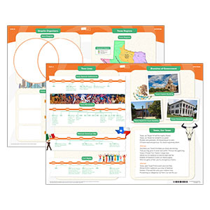
Place Mat
Engaging and developmentally appropriate, the Texas Place Mat integrates primary and secondary sources to support skill-building activities.
U.S./World Desk Map
The dual-sided map features a U.S. map with state names and a world map with continents distinguished by color and national boundaries. (11″h x 17″w)
Raised Relief Map
This U.S. natural regions map is a tactile resource that helps students explore the physical geography of the United States. (28″h x 18″w)
9-inch Activity Globes
These durable globes highlight countries with bold colors, clearly labeled continents, and simplified latitude/longitude lines for easy learning.
Wet-Erase Markers
Specially designed for the program, these markers ensure a mess-free and long-lasting classroom experience.
This title is part of the series: ENCOMPASS: EXPLORING TEXAS, GRADE 4

