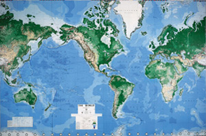
EXECUTIVE WORLD MAP
Wall Mural
Wall mural
Connect with a representative to create a custom curriculum for your district.
A huge political-physical map of the world comes ready for pasting on your classroom wall. Vibrant shades of blue, green, and brown are graduated according to terrestrial altitude or marine depth.
The map shows national boundaries, major and capital cities, lines of latitude and longitude, important sea lanes (with distances), major sea floor features, altitudes and depths (expressed in meters), and time zones in an inset map. The map can be marked with wipe-off pens—one included—and erased. Measures 8 feet 8 inches high by 13 feet wide when its eight individual panels are assembled, but can be trimmed to accommodate doors, windows, or a smaller wall. Paste and step-by-step instructions included. Includes South Sudan. Mercator projection.
| Publisher | Environmental Graphics |
|---|---|
| Run Time | 2013 |

