INTERACTIVE PERTHES MAP AND ATLAS
COMPLETE SET: 2 DVD-ROMs
Connect with a representative to create a custom curriculum for your district.
Two digital presentation tools combine to give teachers unprecedented depth and flexibility in their geography instruction.
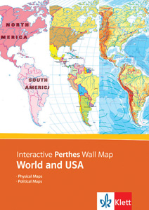
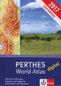
The Interactive Perthes Wall Map: World and USA, with its many layers of information, allows users to fine-tune the complexity or simplicity of physical and political maps of the world and the United States. The Digital Perthes World Atlas equips users with a map interpretation tutorial, 70 thematic world maps, and 90 maps (physical, political, and thematic) of the continents and their regions. Both tools allow teachers to zoom in and out, mark important features with a drawing tool, and export or print any map or section of a map. Multiple-user site licenses are available.
| Copyright | 2009, 2017 |
|---|---|
| Publisher | Klett |