INTERMEDIATE PHYSICAL CLASS PACK
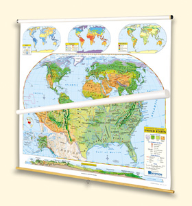
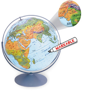
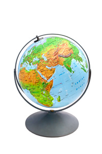
This globe and its matching world and U.S. maps (all markable) equip students who have become familiar with cartographic conventions for classifying forest, grassland, desert, and alpine biomes, while shaded relief plainly reveals mountainous areas. All show capital and major cities (with type size denoting population), landforms and water features, and longitude and latitude, with the maps including inset thematic maps: rainfall, temperature, and land use. Additional U.S. map insets show a locator map, Alaska, Hawaii, and a transcontinental cross-section elevation profile. The maps measure 54″h x 65″w and come mounted on one heavy-duty metal spring-roller with a backboard designed for hanging from a map rack or a one-inch map rail (not included). The maps are also available separately. The 16″ 3-D raised-relief globe in the pack comes in a Gyro-disc mount; other mountings and a 12″ size are also available.
Additional sets available:
- PHYSICAL AND POLITICAL DUAL MAP SETS. These map sets give two views: a political view that reveals each state or country’s shape and a physical view that distinguishes different biomes.
- INTERMEDIATE PHYSICAL AND POLITICAL WORLD AND U.S. FOUR-MAP SET. Four maps on one roller—the physical world, the political world, the physical U.S., and the political U.S.—help students see how physical geography influences political geography.
This title is part of the series: INTERMEDIATE PHYSICAL CLASS PACK
| Publisher | Nystrom |
|---|---|
| Grade | 4–5 |