EARLY LEARNING MAPS AND GLOBES CLASS PACK
Grades K–1
CLASS PACK: 2 maps on 1 roller with backboard, 16" globe in Gyro-disc mount
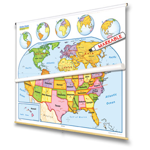
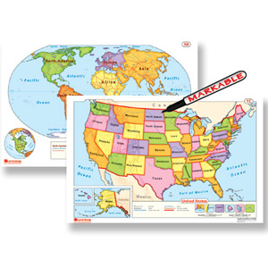
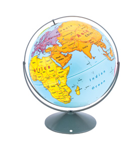
This United States map, world map, and globe (all markable) combine to provide basic geographic information using simple cartographic symbols and conventions. The world map and the globe emphasize continents by making each one a different color; country boundaries are shown as red lines, with each country labeled by name. To keep the presentation simple, longitude and latitude are omitted (except the Equator) and no cities are shown. The U.S. map emphasizes states by color, with each state labeled; capitals and a few of the most major cities are shown. U.S. insets include a locator map, Alaska, and Hawaii; five world-map insets rotate globe views to put different continents front and center. Both maps have shaded relief and legends that explicitly explain how map symbols and conventions work. The maps measure 54″h x 65″w and come mounted on one heavy-duty metal spring-roller with a backboard designed for hanging from a map rack or a one-inch map rail (not included). The maps are also available separately. The 16″ 3-D raised-relief globe in the pack comes in a Gyro-disc mount; other mountings and a 12″ size are also available.
| Publisher | Nystrom |
|---|---|
| Grade | K–1 |
| ISBN | 9780782529142 |