
LAND COVER CONTINENTS AND REGIONS MAP SERIES
Discover how the world’s landscapes shape ecosystems, climates, and human activity with the Land Cover Continents and Regions Map Series. From dense forests to vast deserts, these interactive maps give your students a closer look at how different regions around the globe are covered by natural and human-made features. Whether you’re teaching about rainforests in South America or the tundras of the Arctic, these maps are a great tool for visualizing the planet’s diverse land covers.
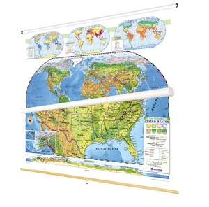
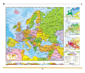
Each 42″h x 54″w map features naturalistic colors marking eight types of land cover: cropland, grassland, desert and semi-desert, tundra, glacier, broadleaf forests, needleleaf forests, and tropical rainforests. Thematic insets vary by map and often include details such as rainfall, population, growing season, and cross-sectional elevation profiles. Boundary lines mark labeled states or countries, with capital and major cities displayed (and populations indicated by type size and symbol size). Shaded relief shows the locations of mountain ranges, both terrestrial and subsea, and latitude and longitude lines are clearly delineated for easy reference.
Printed on durable, tear-resistant stock, these maps are markable with wet-erase markers, encouraging students to engage directly with the content. The maps come mounted on spring rollers with backboards, designed for easy hanging from a map rack or one-inch map rail (required). If you prefer a different setup, individual roll-down maps are available, and the entire set can be purchased as flip charts on sturdy tripods for flexibility.
This map series provides students with a comprehensive understanding of how land cover influences weather patterns, ecosystems, and human activity across the globe. With engaging visuals, practical thematic insets, and multiple format options, these maps are built to last and perfect for hands-on learning.
Five specialized map sets are available:
- The 7-map World and Continents set includes Africa, Asia, Australia and Its Neighbors, Europe, North America, South America, and the World.
- The 7-map Continents and Regions set includes Africa, Asia, Australia and Its Neighbors, Europe, the Middle East, North America, and South America.
- The 6-map Continents and Regions set includes Africa, Asia, Australia and Its Neighbors, Europe, North America, and South America.
- The 5-map Eastern Hemisphere set includes Africa, Asia, Australia and Its Neighbors, Europe, and the Middle East.
- The 4-map Western Hemisphere set includes Canada, Middle America, North America, and South America.
This title is part of the series: LAND COVER CONTINENTS AND REGIONS MAP SERIES
| Size | |
|---|---|
| Publisher | Nystrom |
| ISBN | 9780782541700 |
Related products
-
NYSTROM U.S./WORLD LAND COVER MAPS
$335.00 Add to cart -
NYSTROM POLITICAL-RELIEF CONTINENTS MAP SETS
$599.00 Add to cart -

7-MAP WORLD AND CONTINENTS SET on 1 roller with backboard
POLITICAL RELIEF CONTINENTS AND REGIONS MAP SERIES
$729.00 Add to cart -
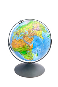
12″ LAND COVER RAISED-RELIEF GLOBE
$169.00 Add to cart -
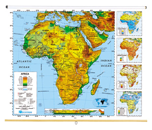
AFRICA
$210.00 Add to cart -

AUSTRALIA
$210.00 Add to cart -

CANADA
$210.00 Add to cart -

EUROPE
$210.00 Add to cart -

MIDDLE AMERICA
$210.00 Add to cart -

MIDDLE EAST
$210.00 Add to cart -

NORTH AMERICA
$210.00 Add to cart -

SOUTH AMERICA
$210.00 Add to cart